GPS Trackers for Homeowners & Small Businesses: Why GPS Accuracy Changes Throughout the Day
gps trackers are essential tools for property owners, fleet managers and security professionals, but their measured location can shift over hours for reasons that are mostly environmental and systemic. This article examines satellite geometry, atmospheric dynamics and local signal quality factors that cause daily variation, explains how to interpret device diagnostics, compares mitigation approaches, and maps practical selection logic for homeowners and small businesses.
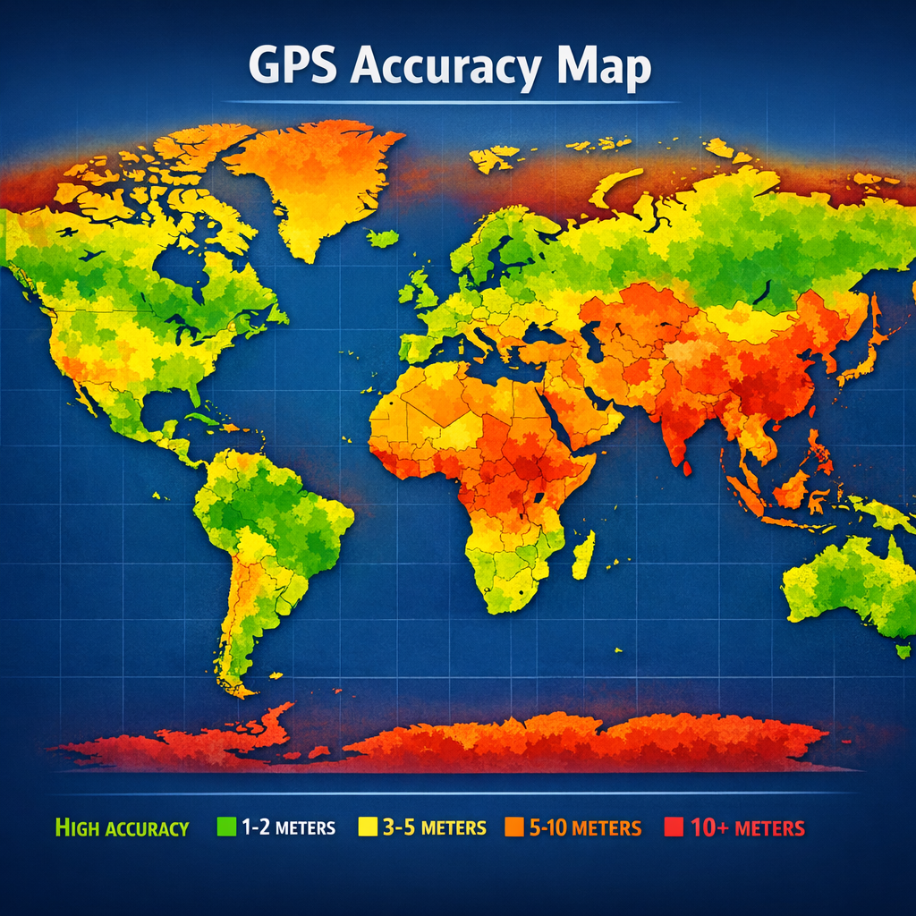
How gps trackers and satellite geometry create time-of-day variation
Satellite geometry—how satellites are positioned relative to a receiver—directly affects positional dilution of precision (PDOP), a mathematical measure of geometric strength. As satellites orbit, PDOP changes on predictable cycles: certain times of day will naturally produce tighter geometry and lower PDOP, improving gps accuracy; other times create higher PDOP and wider uncertainty. Satellite visibility also depends on constellation composition (GPS, GLONASS, Galileo, BeiDou) and whether a device supports multi‑constellation tracking. Devices that track more constellations typically see smaller swings in reported accuracy because they can choose the best geometry from more satellites.
Environmental drivers of gps accuracy fluctuations and signal quality
The atmosphere is a dominant, time-varying influence. The ionosphere and troposphere bend and delay GNSS signals differently across the day. Ionospheric effects intensify around sunrise and sunset and during solar activity; daytime ionization can introduce predictable delays that degrade accuracy if not modeled by the receiver. Tropospheric humidity and temperature also seasonally and diurnally alter delays. Multipath—reflections from buildings, glass and water—changes with satellite elevation and local activity (moving vehicles, doors opening), so urban canyon environments often show larger short-term swings in signal quality and measured position.
Key atmospheric and environmental mechanisms
- Ionospheric delay: varies with solar radiation; strongest near solar maxima and during dawn/dusk.
- Tropospheric delay: correlated with humidity and pressure; changes slowly but affects vertical positioning.
- Multipath: dependent on surroundings and satellite angle; causes rapid, localized errors.
- RF interference & urban noise: can be diurnal when industrial or radio use peaks.
Comparing device-level factors that affect daily gps trackers performance
Not all gps trackers respond to the same conditions in the same way. Antenna design, receiver chip sensitivity, firmware filtering and reporting intervals influence both raw position and the reported measure of gps accuracy. External magnetic or metal structures near a receiver reduce signal quality more persistently than transient atmospheric effects. High-sensitivity GNSS modules capture weaker signals and mitigate some short-term losses, but they may increase power draw. Devices that provide richer diagnostics—number of satellites, PDOP, signal-to-noise ratio (SNR) per satellite—allow operators to distinguish environmental causes from hardware faults.
Pros and cons of common hardware approaches
- Internal low‑profile antennas: lower cost, smaller; more susceptible to multipath and indoor attenuation.
- External active antennas: improved signal quality and satellite visibility; require mounting and cabling.
- Multi‑constellation receivers: better geometric diversity; may cost more and need firmware support.
- RTK or differential solutions: sub‑meter accuracy when infrastructure is available; complexity and coverage limit general use.
When choosing a tracker, weigh these options against the use case: a delivery van benefits from multi‑constellation with external antenna, while a home asset tag may prioritize low cost and battery life.
Use cases: interpreting daily patterns for homeowners, small businesses and professionals
Homeowner scenario: a homeowner monitoring a shed or garden tractor will see larger daily swings when the device sits under tree canopy. Morning accuracy may improve as leaves dry off, reducing multipath compared with humid nights. Simple placement adjustments—moving the device to higher or less obstructed positions—often yield immediate benefit.
Small business fleet: delivery operations report consistent early‑morning PDOP patterns as vehicles depart storage yards. Fleet managers should review device diagnostics during known low‑PDOP windows to establish baselines and then compare in-route data to detect true anomalies versus expected diurnal drift. Read the complete GPS Trackers guide Use a pillar resource when building operational standards or integrating telematics data into dispatching workflows.
Professional evidence collection: security professionals gathering location proof must document signal quality, satellite counts and device settings at the time of each fix. Collecting metadata reduces later disputes about accuracy; where possible, capture multiple fixes across expected high and low PDOP periods to show consistency.
Buyer guide: evaluating gps trackers for consistent daily accuracy
When evaluating devices, prioritize metrics and features that improve signal quality and allow diagnosis. Important criteria include:
- Multi‑constellation support: reduces sensitivity to satellite geometry swings.
- Reported diagnostics: SNR, satellite count, PDOP/HDOP values help distinguish environmental from device issues.
- Antenna options: choose external active antennas for vehicles or fixed installations to improve reception.
- Reporting interval and smoothing: longer intervals and filtering can hide short-term noise but may delay detection.
- Power management: ensure sampling duty cycles do not create aliasing effects where motion occurs between fixes.
Avoid common procurement mistakes such as selecting devices solely on advertised meter figures without checking how those figures were measured, or ignoring the importance of diagnostics that report signal quality rather than just a location point. Browse GPS Trackers If you need a rapid inventory of available device types, consult the category overview for typical features and form factors.
Practical examples and common mistakes
Example 1: A small landscaping business tracked trailers that suddenly reported 10–20 meter jumps each afternoon. Investigation showed trucks were parked near a glass facade; afternoon sun changed reflection angles and produced multipath. Corrective step: reposition parking and add an external antenna on a metal mast.
Example 2: A homeowner saw consistent 5–10 m vertical error at night. The device used a single‑constellation module with poor elevation mask handling. Upgrading to a multi‑GNSS device and enabling automatic elevation masks reduced vertical scatter.
Frequent mistakes include expecting indoor devices to match outdoor accuracy, ignoring firmware and almanac updates that affect satellite selection, and misinterpreting vendor‑stated accuracy as guaranteed under all environmental conditions. Regular monitoring of signal quality metrics is the simplest way to avoid misdiagnosis.
Legal and ethical considerations (high-level guidance for EU and US)
Operating gps trackers carries legal and privacy obligations that vary by jurisdiction. In the US, federal laws address interception and surveillance in limited contexts, while state laws often regulate employee monitoring and consent. Employers tracking vehicles generally need clear policies, notice and limited retention practices to reduce legal risk. In the EU, the General Data Protection Regulation (GDPR) treats location data as personal data when it can identify individuals. That requires a lawful basis for processing, transparent notices, data minimization, and rights for data subjects. Privacy by design—collecting the minimum data necessary and protecting signal logs—is a best practice in both regions.
For evidentiary use, understand chain-of-custody, device tamper logs, and whether your device vendor provides timestamp and integrity assurances. High-level compliance steps include maintaining documented consent or legitimate interest assessments, clear retention schedules, and protocols for responding to subject access requests. Discreet solutions Refer to the operational guidance in the tracking operations pillar when formalizing policies and evidence procedures.
Frequently Asked Questions
Q1: Why does my gps tracker show different accuracy in the morning versus afternoon?
A1: Differences arise from changing satellite geometry, ionospheric conditions at dawn and dusk, and local factors like humidity or reflections; reviewing PDOP and SNR logs at those times helps diagnose causes.
Q2: Can installing an external antenna eliminate daily accuracy swings?
A2: An external antenna improves satellite visibility and often reduces multipath, but it cannot eliminate atmospheric or large-scale geometric effects; it reduces local contributors to poor signal quality.
Q3: Are multi-constellation trackers worth the extra cost?
A3: For operations needing consistent availability and smaller accuracy variance, multi‑constellation devices generally reduce swings and improve signal quality, making them cost‑effective in many small business and professional contexts.
Q4: How should I log data to support legal disputes about location?
A4: Record raw device diagnostics (satellite counts, PDOP, SNR), timestamps, device configuration and chain‑of‑custody notes. Retain original logs and export copies to prevent tampering.
Q5: Do solar storms significantly affect gps trackers?
A5: Strong solar activity can increase ionospheric disturbances and temporarily degrade gps accuracy and signal quality; mission‑critical operations should monitor space weather advisories and use redundancy where needed.
Closing summary: Understanding why gps trackers vary across a day requires combining knowledge of satellite geometry, atmospheric physics, local environment and device design. Homeowners and small businesses can often reduce variability with thoughtful placement, diagnostic monitoring and choosing multi‑constellation or external antenna options when needed. Professionals should add documentation and privacy controls to operationalize accuracy expectations objectively.